GTRI News & Features

02.13.26
GTRI 2025 Annual Report
The digital edition of GTRI's 2025 Annual Report provides an overview of our accomplishments, research investments, and outreach programs.
Read More >>


GTRI News

- News stories
Two Georgia Tech Research Institute (GTRI) researchers are among the latest Georgia Tech innovators selected for Tech Ready Grants, an Office of Technology Licensing program… Read More >>

- News stories
The latest episode of the Georgia Tech Research Podcast features a conversation with Mike Gazarik, Ph.D., director of the Georgia Tech Research Institute (GTRI) and senior vice… Read More >>
- News stories
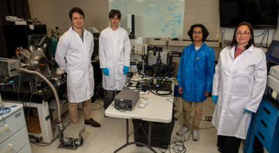
Georgia Tech researchers, led by the Georgia Tech Research Institute, are sending new polymers to the International Space Station to study their durability in harsh space… Read More >>

- News stories
The Dixie Crow Chapter of the Association of Old Crows (AOC) celebrated the 50th anniversary of its annual Symposium in late March. GTRI showed its support during the 50th… Read More >>

- News stories
GTRI researchers are supporting the Quantum Benchmarking Initiative, a project of the Defense Advanced Research Projects Agency (DARPA) to evaluate approaches being pursued by a… Read More >>

- News stories
An optical principle discovered more than a century ago may soon find new applications in such areas as monitoring atmospheric turbulence, tracking airborne objects, and mapping… Read More >>

- Featured Stories
The digital edition of GTRI's 2025 Annual Report provides an overview of our accomplishments, research investments, and outreach programs. Read More >>

- Featured Stories
GTRI in Photos showcases our favorite pictures of GTRI research and operations in action. Read More >>